The National Maritime Authority and the Navy warned The worsening of maritime unrest in Portugal. continental from Thursday to Sundaypredicting waves that could reach a maximum height of 17 meters.
In a statement, the National Maritime Authority states that forecasts point to “a considerable worsening of weather conditions and sea disturbances on the west coast of mainland Portugal from 00:00 on November 2 to 18:00 on Sunday.” November 5th”. .
“The agitation of the sea will be characterized by a wave coming from the northwest quadrant, with a significant height that could reach 10 meters and a maximum height of 18 meters, with an average period that will vary between six and 12 seconds,” the statement reads. note. .
Over there #BorrascaCiarán will shake your fish #North Atlantic. The maximum individual oil estimated by #ECMWF It exceeds 23 meters in height. pic.twitter.com/ClYJyGyxXG
— Storm Málaga (@Storm_Malaga) October 31, 2023
Winds are also expected from the northwest quadrant, with an average intensity of up to 85 kilometers/hour and gusts up to 150 kilometers/hour.
In this way, the authorities alert the maritime community and the population in general to be careful both when preparing to go to sea, and when they are at sea or in coastal areas, from reinforcing moorings to close surveillance of moored and anchored vessels.
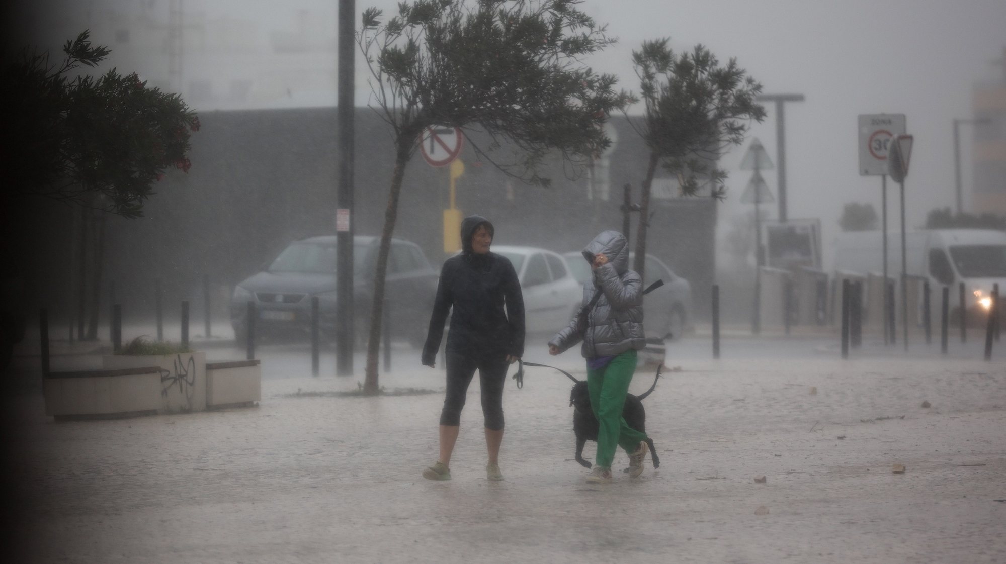
It is also requested that walks near the sea or in areas exposed to disturbances from the sea, such as protective piers in ports, cliffs or beaches, be avoided.
The Maritime Authority also asks that recreational fishing not be practiced, especially near cliffs and cliff areas, “often affected by breaking waves, always taking into account that in these conditions the sea can easily reach apparently safe areas.” ”.
Civil Protection Alerts for floods and water tables
The National Authority for Emergencies and Civil Protection (ANEPC) also issued an alert to the population about the worsening of the situation. weather conditions for the next 48 hours, with wind and heavy rain, rough seas and snowfall.
Based on the forecasts of the Portuguese Institute of the Sea and the Atmosphere (IPMA), the ANEPC warns of the appearance on Wednesday of periods of rain or showers, sometimes intense, north of Cape Mondego in the morning and on the north coast, starting in the late afternoon, as well as persistent rainfall in the mountainous regions of Miño and Duero Litoral, which may exceed 40 millimeters (mm) in six hours.
Strong winds are forecast for the same day, with gusts of up to 70 km/h on the north coast, which at the end of the day can reach up to 90 km/h in the north and center, associated with sea disturbances on the coast. west coast, north of Cape Raso, with waves of four to five meters.
For Thursday, the ANEPC warns of a similar scenario, with periods of rain, sometimes intense, to the north of the Montejunto-Estrela mountain system until early in the morning, which will change to showers in the afternoon, and towards possibility of snowfall above 1200/1400 meters altitude.
With the heavy pace on Thursday, a colder air mass will enter. This will have the following consequences:
1. The snow level will improve in the afternoon and evening, giving way to snowfall in the mountains from approximately 1,200 m, although there will be less precipitation. pic.twitter.com/sHPQ6UUmQX— TiempoMadrid (@carlosweder_) October 31, 2023
The forecasts for Thursday also point to strong winds in the northern and central mountains, with gusts of up to 100 km/h and strong sea agitation south of Cape Raso, with waves of five to seven meters that will reach 14 meters in height. .
Regarding the hydrological situation in the north of the country, the ANEPC warns, based on the forecasts of the Portuguese Environment Agency (APA), for the Miño River basin, where the flow remains above 800 cubic meters per second, “which could increase slightly if there are discharges into the Frieira dam, while the Lima River remains in a state of ‘yellow alert’ due to the possibility of an increase in discharges from the Alto Lindoso-Touvedo system.”
In The Cávado River basin remains in a state of “yellow alert” due to the possibility of an increase in discharges from the Caniçada dam..
Given all the forecasts, especially intense rainfall, strong winds and rough seas, the ANEPC warns of the appearance of floods in urban areas, caused by the accumulation of rainwater, the obstruction of drainage systems or by coastal overflows, as well as flooding, increased by the overflowing of the channels of some water courses, rivers and streams.
It also warns of the instability of the slopes, which causes landslides and landslides caused by water infiltration, a phenomenon that may be increased by the elimination of the vegetation cover after the rural fires last summer or by the artificialization of the soil.
Also take into account in the next 48 hours the slippery surface of the road due to the possible formation of water tables or accumulation of ice and/or snowPossible accidents on the coast, due to strong agitation of the sea and dragging of loose objects onto the roads or detachment of mobile or poorly fixed structures, due to strong wind, which can cause accidents with vehicles in circulation or pedestrians on public roads. roads.
The ANEPC leaves the population with the usual recommendations to ensure the unblocking of stormwater drainage systems and the removal of inert materials and other objects that may be dragged or create obstacles to the free flow of water; adequate fixation of loose structures, in particular scaffolding, signs and others that are suspended, and special care when circulating and remaining near wooded areas, due to falling branches and trees.
It also recommends special care when traveling through coastal and riparian areas historically more vulnerable to coastal flooding, not carrying out activities related to the sea, such as sport fishing, water sports and walks along the seashore, and also avoiding parking vehicles too close. Together from the seafront.
Drivers are recommended to drive defensively, reducing speed and paying special attention to the possible accumulation of snow and/or formation of groundwater on the roads and not crossing flooded areas, in order to prevent people or vehicles from being swept away. towards the holes in the track. floor or open drains.
Incoming storm Ciarán…
A violent wind storm is currently brewing in the open waters of the Atlantic.
Unfortunately, Ciarán reaches its maximum intensity upon reaching European coasts and severe weather warnings are issued.
THREAD pic.twitter.com/MeZTF3ZJZV
—Scott Duncan (@ScottDuncanWX) October 31, 2023
The blame lies with the serious Ciarán depression, which is moving in the Atlantic towards the east, with a front that will affect mainland Portugal and Madeira starting on Thursday, with winds and heavy rainfall, mainly in the north and center.
The institute also forecasts that “a very significant increase in maritime agitation on day 2 on the west coast, where waves are expected to be from the northwest and reach between five and seven meters of significant height, and with a high probability of exceeding seven meters.” , specifically the north of Cabo Raso.”
“This episode should last until November 6,” estimated the IPMA.
Source: Observadora