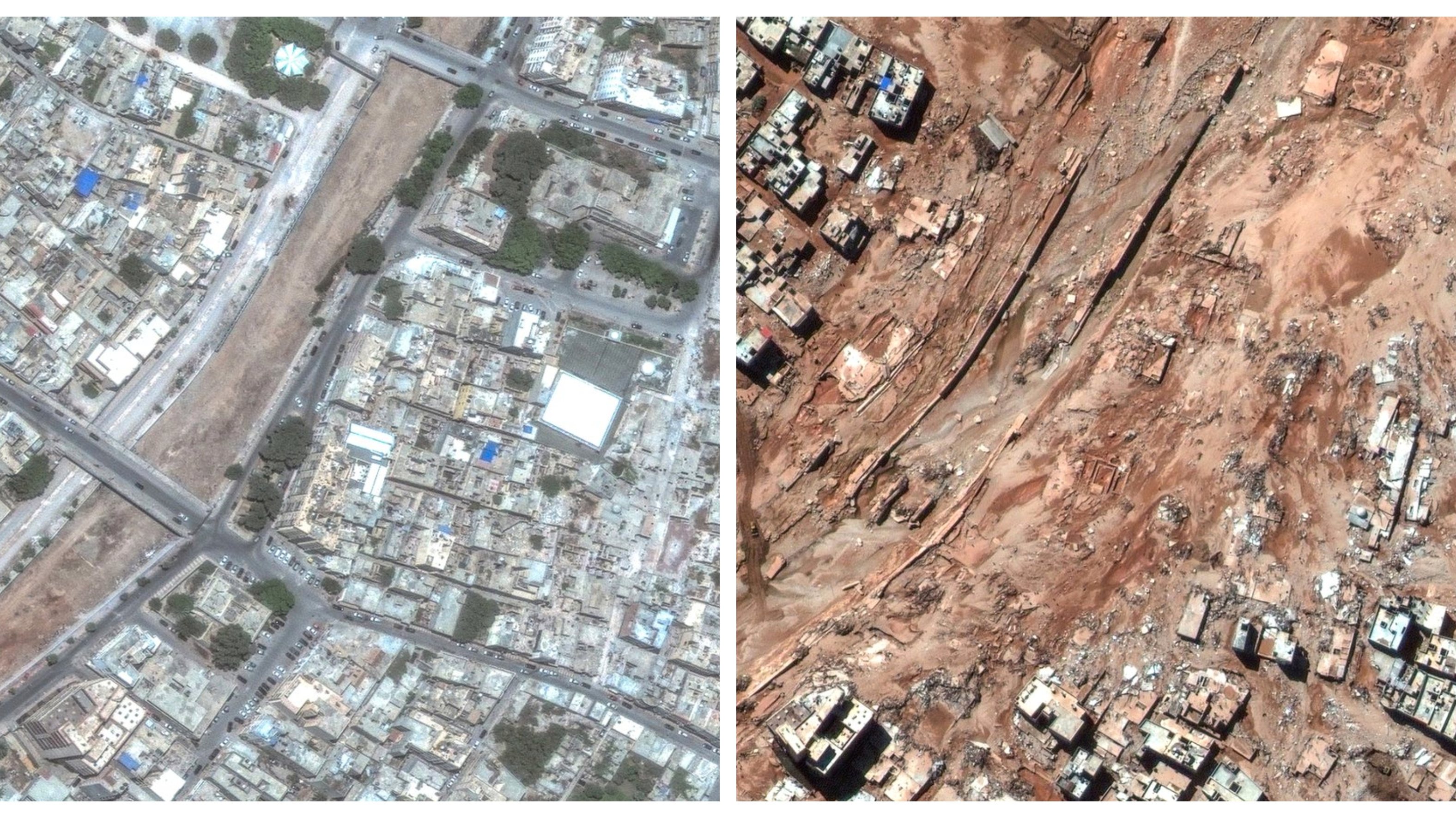
Satellite images allow a before and after comparison of the coastal city of Derna, in Libya, hit by torrential rains. At least six thousand people died, but the figure could increase to 20 thousand.
Satellite images, captured by Maxar Technologies, a private space technology company based in the United States, show what the city of Derna, in Libya, looked like after being hit by floods last Sunday.
On the night of September 10, Storm Daniel hit the coastal city with torrential rains that caused the failure of two dams, located a few kilometers from inhabited areas, releasing 33 million liters of water that devastated entire neighborhoods and the four bridges that They cross it. .the river Derna to the sea.
In the latest update, official figures point to six thousand dead and around 10 thousand people missing. The Red Cross estimates that the death toll could reach 20,000.
In the interactive blocks prepared by the Observer, with the photographs released by Getty, it is possible to compare the before and after of various areas of the coastal city of Derna. To see changes after September 13, simply drag the vertical white bar, located in the middle of the images.
In several areas, most houses were submerged, as were streets and highways. It is estimated that the floods left more than 30,000 people homeless in Derna alone.
According to the National Meteorological Center of Libya, the rainfall caused by Storm Daniel exceeded 400 milliliters per hour, a value that had not been recorded for four decades.
According to experts, one of the reasons for the rapid collapse of the dams could be the poor state of their infrastructure, the lack of safety measures, as well as the lack of maintenance.
Source: Observadora
