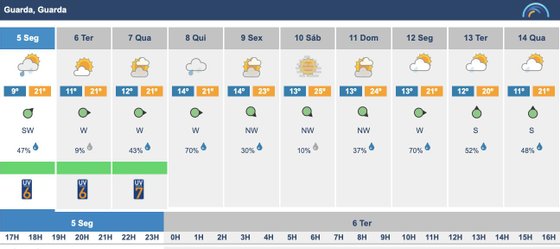
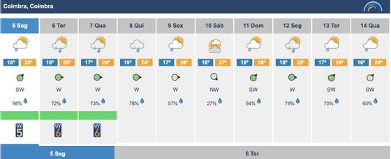
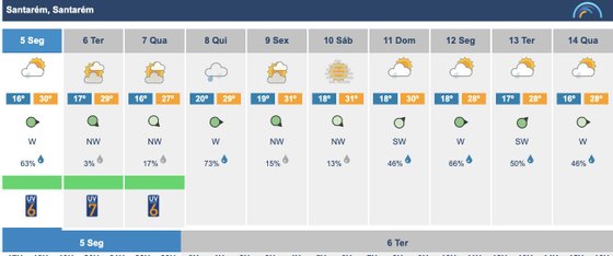
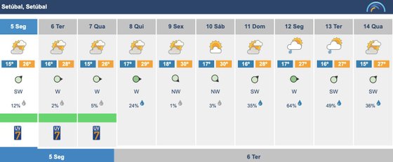
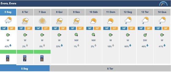
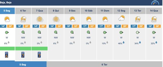
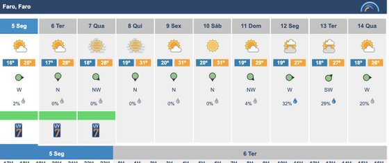
Good news: Hurricane Danielle, which continues at least until the middle of this week in front of the Azores in threatening mode, should then continue its path north and move away from our coast, eventually dissipating, being very unlikely to affect the weather. the Iberian Peninsula. Peninsula. Bad news: a storm in the northwest of Galicia has put some northern regions on a yellow alert this Monday due to heavy rains and this rain will become a constant from Thursday in almost the entire country: the Algarve escapes and the Alentejo this early fall should only make it to the weekend. Even so, you have to count on fog and cloudy skies. The maximum temperatures will be below 30ºC and the minimum below 20ºC.
This is not good news for those who took a vacation in these first weeks of September, but that is what can be fixed.
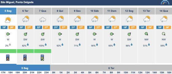
Starting with Hurricane Danielle —although its path remains uncertain and always depends on the temperature of the waters it finds in its path (any warmer current will make it take a turn at any moment)—, the forecasts are that it will continue north , deviating from the Iberian Peninsula, and the tropical storm is expected to pass from Wednesday, when it enters the coldest parts of the Atlantic. If confirmed, it is unlikely to affect the Iberian Peninsula, although it does not stop influencing the meteorology of the Azores Islands (which it will pass through tomorrow), and it can also affect the coast of northern Portugal and Spain. .
the hurricane #danielle It will move in the next few hours to the northeast. You will find colder waters and unfavorable atmospheric conditions, which will weaken you. When it is close to Europe it will become a storm. Its effects, with high probability, will not be noticed in Spain. pic.twitter.com/ycS5Suftnq
— AEMET (@AEMET_Esp) September 5, 2022
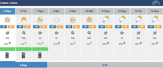
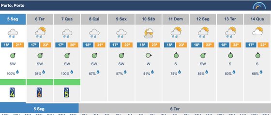
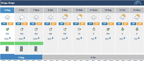
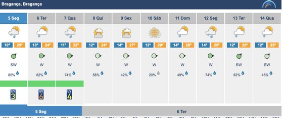
Now the second part of the conversation, the time that awaits us for the next few days. The rain has already begun to affect the north of the country this Monday, due to a storm of this type that formed in the northwest of Galicia. The possibility of rain and strong winds even led the IPMA to put the districts of Viana do Castelo, Porto, Braga and Vila Real under a yellow warning from noon. For tomorrow, Tuesday, the rain should remain strong in Minho and Douro Litoral and extend to the center during tomorrow. The rest of the country will have cloudy weather and the wind will be constant.
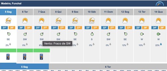
These grayer days at the beginning of the week will have a slight respite on Wednesday, which will be a bit sunnier: at least in the south, since in the north the rain may not stop. But on Thursday then begins a week of early autumn (albeit with high temperatures).


The clouds are here to stay and the rain too. On Thursday probably (it is still too early to make forecasts) only in the north and center, on Friday in the area of Lisbon and the Tagus Valley and from the weekend even in Alto Alentejo. The only completely safe region for now seems to be the Algarve, although it is not immune to clouds and morning fog. Oh, and the temperatures, these are the ones that show that we have even moved to a moderate climate: almost the entire country will be below 30ºC maximum and below 20ºC minimum. And to the north there will be cities with nights between 12 and 14ºC (brrrrhhh!).
Bad luck if you’re on vacation at this time, although you can always put on a little color if you’re in the south. Even so, with the inconvenience of having to carry a small bag or a sweat in your suitcase to go to a terrace or to go out at night.
Source: Observadora
