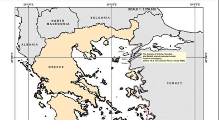
The Greek Ministry of Foreign Affairs published 16 maps on its website showing Turkey’s “attempts to change the status quo and violate international law” in the Aegean and Eastern Mediterranean regions, explaining that the interpretation accompanying the map reads: “This reflects the demands on the revision of the status quo in the region in 1973-2022” in relation to the Greek territorial waters, the continental shelf and the islands.
To better understand Turkey’s broad overview, the attached maps clearly and unambiguously illustrate Turkey’s illegal unilateral actions and claims. The maps begin with the status quo enshrined in the Lausanne Treaties (1923) and the Paris (1947) Turkish claims. began with the illegal issuance of an oil exploration license to the Turkish State Oil Company (TRAO) on the Greek continental shelf in the northern Aegean Sea in 1973, including an attempt to remove responsibility from Greece for conducting search and rescue operations in half of the Aegean Sea in the 1980s , theory of “gray zones” (areas of Greek territorial waters and islands disputed by Turkey) in the 1990s, escalation with new licenses (for geological exploration) in the eastern Mediterranean, acceptance as principles of the Officially “Blue Homeland” (Ankara’s claims on the vast territorial waters and the territorial shelf in the Aegean, Mediterranean and Black Seas), the “Turkish-Libyan Memorandum” and now the Turkish theory of the regime for the demilitarization of the islands of the Aegean Sea.
She pointed out that “the published maps show the scope of Turkey’s review aimed at changing the status quo, violating international law and international maritime law and endangering peace, security and stability in the region.”
Source: El Nashra
